
A historically snowy day was seen Wednesday across the South Coast of British Columbia.
A potent storm brought varied snowfall totals, preliminary at this point, highlighting the difference in accumulations across Vancouver Island, while more consistent totals were found across the Lower Mainland.
DRIVERS BEWARE: Check current road conditions if you have to travel
Vancouver International Airport (YVR) reported 25 cm of snowfall by Wednesday afternoon, making it the second-snowiest January day on record and the snowiest since Dec. 24, 2008. Higher totals were found inland from YVR, where 25 cm fell in North Delta, 31 cm was documented in Port Coquitlam, and 29 cm was reported in Surrey.

In any case, travel was heavily interrupted during the day, including delayed and cancelled flights, alongside numerous power outages.
Keep in mind, with the temperatures cooling Wednesday overnight and clearing possible across the Lower Mainland, streets will remain very treacherous, with more likely school cancellations and travel issues on Thursday morning.
As this storm gets pushed into the rear-view mirror, we’re already eyeing the next snowfall event, with the threat of freezing rain, as well, for Thursday and Friday. What we know so far can be found below.
Thursday and Friday: More snow, potential freezing rain ahead
Another low-pressure system is churning toward the coast, and this time, Pacific air will win out, eventually. The risk of freezing rain is elevated across some areas.
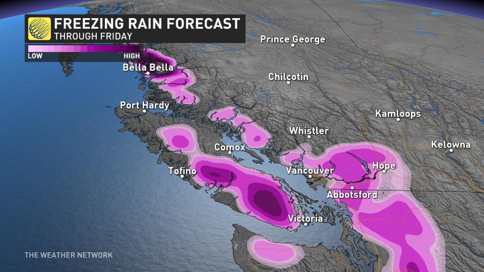
Stubborn cold will remain trapped across inland sections of Vancouver Island the mainland of B.C.m meaning a prolonged, wintry mix is in store for some communities.
By late Thursday afternoon, periods of snowfall once again are forecast across Greater Victoria, with a stubborn outflow continuing. An additional 5-10 cm of snowfall is possible for these regions, with lesser amounts in downtown Victoria.

Much of Eastern Vancouver Island can also expect an additional 5-8 cm of snowfall through the evening, before changing to rain at sea level. The Malahat is still forecast to be slick with the risk of freezing rain and a wintry mix lingering into pre-dawn hours Friday.
Finally, a warm push transitions eastern Vancouver Island and Greater Victoria into rainfall by early Friday morning. Places up near Campbell River will likely remain as snowfall until Friday morning.

During this messy transition, inland sections of Vancouver Island should also be on the lookout for up to a few mm of ice accretion.
As the precipitation moves in Thursday evening, it’s likely to start off once again as snowfall, but just a few cm of snowfall is expected with this round before a freezing rain event unfolds across the Fraser Valley.
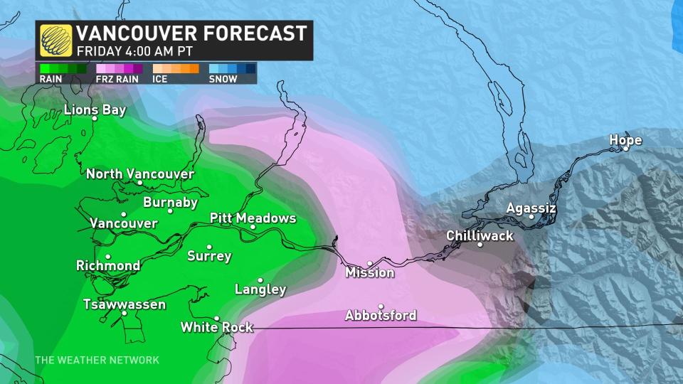
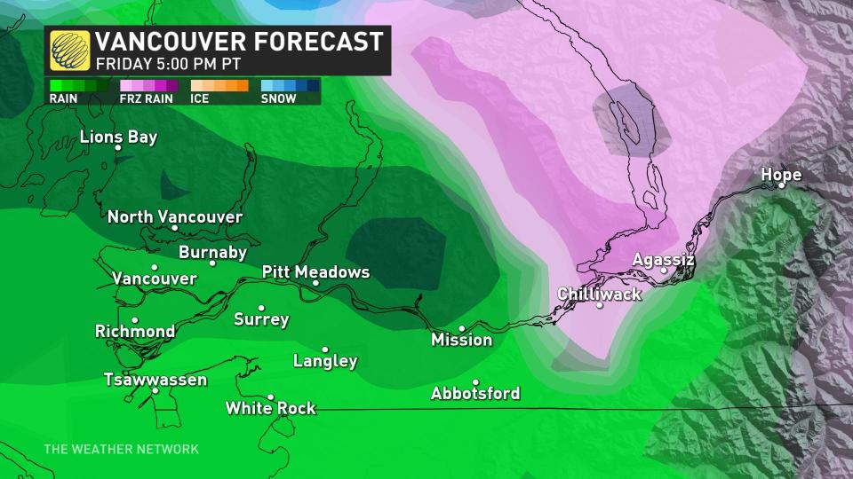
By Friday overnight, most of the colder air is flushed out of the Fraser Valley, with the potential for 5-10 mm of ice accretion with this upcoming event.
Storm drains that aren’t properly cleaned from the 30 cm of snowfall will result in localized flooding, with the addition of up to 30 mm of rainfall across the area.
An active and unsettled pattern will continue into the weekend and through most of next week. Mild Pacific air will take over through the end of January, with snow levels rising to 1000-1500+ metres, resulting in snow and rain for South Coast ski areas.
Thumbnail courtesy of Mike Hanafin/X, taken in Vancouver, B.C.
Stay with The Weather Network for more updates and information on your forecast in B.C.